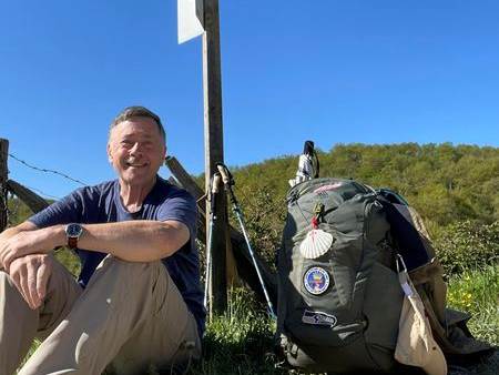
Brent is a transplant from Washington State, making Arizona his home about two years ago. Brent walked the Camino Frances from St. Jean Pied de Port in Spring of 2024 (April 27-June 4)!
Water - Minimum 2 Liters depending on sun & weather. There is NO WATER at the trailhead or along the route.
Hat
Sunscreen
Your own first aid kit
Snacks to refuel
Poles (helpful for strenuous elevation gain)
A leave-no-trace toilet kit. Long hike and no facilities along the route.
There IS NO WATER at the Trailhead.
There are portable toilets.
Please stay home if you are feeling sick.
Call or text your hike leader Tina 602.722.0612 if you are unable to make it or are running late.
No dogs allowed due to chapter liability.
We will share the trail with other hikers and mountain bikers so despite our engaging conversations we will be aware of our surroundings and courteous by stepping off the trail or walking single file when necessary.
Reminders: Our chapter activities are led by volunteers. Donativo contributions (cash only) are greatly appreciated and are used to support future activities. Look for the orange donativo jar by the signup at the beginning of each hike.
We always gather in the spirit of the Camino; therefore the hike leader will maintain awareness of the pace of the group, and will stop periodically at trail intersections to allow all participants to catch up. Hikers/walkers are differently abled and will not finish at the same time. There will be a sweep for larger groups and no hiker will be abandoned. Please review the trail description before signing up to be sure the hike is right for you and your abilities.
Please note freeway construction restrictions along Valley freeways may impact travel time. Visit https://azdot.gov/weekend-freeway-travel-advisory and plan your route and travel time accordingly.
WHITE TANK MOUNTAIN REGIONAL PARK
20304 White Tank Mountain Rd, Waddell, AZ
From 303 - Go WEST on NORTHERN AVE
NORTH on COTTON LANE to Olive Ave
WEST on OLIVE AVE which turns into WHITE TANK MOUNTAIN RD
PAY $7 ENTRANCE FEE (or show Maricopa County annual pass)
CONTINUE ~ 2 MILES
TRAILHEAD STAGING AREA will be on the RIGHT